BWD Map Masking addon for elementor
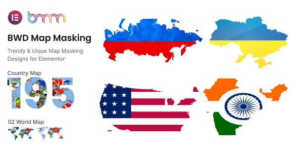
The BWD Map Masking Addon: Vector Clipping Engine & Geospatial Rendering Architecture
The BWD Map Masking addon for elementor operates as a client-side vector masking framework engineered specifically for real estate platforms, travel publications, and regional event directories. The underlying codebase eliminates extraneous wrapper divs and heavy inline canvas calculations, binding SVG clip-path definitions directly to the map container to minimize DOM depth. An asynchronous execution cycle loads the Google Maps JavaScript API via deferred triggers, preventing main-thread script execution bottlenecks while mapping coordinate data onto localized vector nodes.
Integration occurs directly through the native Elementor widget stack, mounting responsive geometry controls into the rendering pipeline without altering core template files. Through the centralized widget panel, administrators control SVG shape paths, border boundary widths, hover transition timing functions, and custom styling schema without writing custom CSS overrides.
Functional Capabilities of the BWD Map Masking Addon in Production
- Arbitrary SVG Mask Geometry: Parses custom XML-based vector paths and predefined geometric presets directly into the CSS clip-path property, isolating iframe map renders within exact brand shapes.
- State-Driven Transition Handlers: Implemented inside the BWD Map Masking Addon, hardware-accelerated CSS transforms execute transitions between default and hover states, adjusting border stroke properties, scale factors, and opacity layers.
- Modular Asset Enqueueing: Conditionally enqueues stylesheet modules and mapping logic only when the widget is parsed on the active page, avoiding global script bloat across unassociated routes.
- Custom Map Styling Schema: Binds custom JSON data directly to the map instance, enabling monochrome, dark mode, or custom branded cartography palettes that adapt dynamically.
Production Implementation Scenarios for the Elementor Map Extension
- Commercial Real Estate Directories: Portals display individual property boundaries clipped to specific architectural silhouettes, improving property profile differentiation while maintaining standard map pan and zoom interactions.
- Tourism and Travel Itineraries: Editorial sites frame regional waypoints inside thematic travel iconography, retaining interactive geographic markers within responsive vector viewports.
- Localized Service Coverage Indicators: Enterprise service providers showcase operational zones using custom polygonal masks, establishing immediate visual clarity regarding delivery radii and service boundaries.
Core Infrastructure and Performance Benchmarks
The codebase requires PHP 7.4 through PHP 8.3 environments and integrates with Elementor Core and Elementor Pro releases without generating deprecation notices or hook collisions. Assets utilize native CSS mask-image and clip-path implementations supported across WebKit, Blink, and Gecko engines without polyfill dependencies.
From a Core Web Vitals perspective, the Elementor map extension prevents Cumulative Layout Shift by establishing explicit aspect-ratio declarations prior to iframe script hydration. First Contentful Paint remains unaffected on non-map templates due to contextual dependency injection that limits script execution strictly to active instances.
Frequently Asked Questions
Does the extension support custom vector paths outside the default preset library?
Yes, the extension accepts raw SVG path strings directly via the widget controls, allowing developers to inject proprietary brand silhouettes or custom regional boundary contours into the clipping matrix.
How does the plugin handle responsiveness across mobile viewport sizes?
Responsive viewport controls scale vector coordinates proportionally using percentage-based bounding boxes, ensuring masked maps maintain spatial accuracy across mobile, tablet, and desktop breakpoints without layout overflow.
Can custom color palettes be applied directly within the widget?
Yes, developers can paste JSON style arrays directly into the widget interface to override standard map colors, aligning geographic visual presentation with the active design system.