
 My Account
Product Description
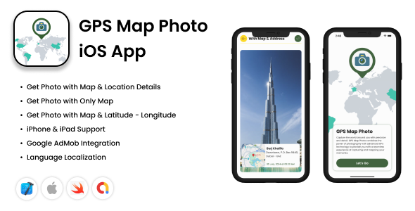
The GPS Map Photo: Geotag Images with Location, Coordinates iOS App source code provides an exceptional foundation for developers looking to create a powerful utility for both professional and personal use. This package allows you to build a sophisticated application that seamlessly integrates a high-resolution camera with real-time GPS data, enabling users to capture images and automatically embed precise geographical information. It’s the perfect solution for anyone needing to create an app focused on verifiable, location-based photo documentation and archival.
Built entirely with modern Swift and SwiftUI, this codebase ensures a smooth, responsive, and native performance that iOS users demand. The architecture is clean, well-commented, and designed for easy customization, allowing developers to rebrand the app, add unique features, or integrate it into a larger project with minimal effort. By leveraging the GPS Map Photo: Geotag Images with Location, Coordinates iOS App source, you are starting with a robust and future-proof product ready for submission to the App Store.
Key Features
- Automatic Geotagging with Live GPS Data
- Customizable Data Stamps (Date, Time, Coordinates, Address)
- Multiple Map Styles Including Standard, Satellite, and Hybrid
- Clean and Intuitive User Interface Built with SwiftUI
- High-Resolution Photo Capture and Saving
- Integrated In-App Gallery for Geotagged Photos
- Modern Codebase Using Swift and SwiftUI
- Pre-Integrated AdMob for Monetization
Use Cases
Professionals across various industries can leverage an application built from the GPS Map Photo: Geotag Images with Location, Coordinates iOS App code. Imagine real estate agents documenting properties with timestamped and located images for client reports, or civil engineers tracking construction progress with undeniable visual proof. Environmental scientists conducting field research and insurance adjusters assessing damage can also rely on it for accurate data collection, as the ability to embed verifiable location, date, and time data directly onto a photo provides irrefutable proof and streamlines reporting workflows significantly.
Beyond the professional realm, this tool is a dream for travelers, adventurers, and social media content creators. A travel blogger can create a more immersive story by showing exactly where each stunning landscape photo was taken, adding a layer of authenticity. Hikers and explorers can map their journeys visually, creating a rich photo log with precise coordinates for sharing or personal records. The GPS Map Photo: Geotag Images with Location, Coordinates iOS App helps transform a simple photo gallery into a detailed, interactive map of memories and experiences.
Benefits
For developers, the primary benefit is the immense saving of time, resources, and development costs. Building a feature-rich geotagging application from scratch requires significant expertise in handling camera APIs, Core Location services, and map integrations. The GPS Map Photo: Geotag Images with Location, Coordinates iOS App source code gives you a market-ready solution, complete with AdMob integration for immediate monetization opportunities, allowing you to focus on marketing, branding, and user acquisition.
End-users of an app built with this code gain a powerful tool for organization and context. They no longer need to guess where a photo was taken or manually log location details in a separate app. Every image becomes a self-contained digital record with accurate coordinates, altitude, address, and customizable timestamps. This dramatically enhances the value of their photo library, making it easier to sort, search, and share memories with rich, verifiable details.
Ultimately, this project serves as a comprehensive toolkit for launching a successful niche utility on the App Store. It addresses a clear and persistent need for accurate photo documentation in a world where location context is increasingly important for verification and storytelling. By acquiring the GPS Map Photo: Geotag Images with Location, Coordinates iOS App source, you are not just buying lines of code; you are investing in a complete, well-engineered product with proven functionality and broad market appeal.






There are no reviews yet.